E - Integrated structural, petrological, geochronological and surface studies
Structural geological, thermo-chronological, petrological and surface studies are planned in the following target areas (stars in Fig. 2b) and themes:
Active and exhumed fault systems (Stars 1, 2; Themes 3 and 4) - Structural and geochronological investigations of fossil faults will yield insight into the rheology of strain localization, as well as constrain the duration of deformation. This is essential for improving kinematic reconstructions of the Alps and yielding estimates of deformation rates (Theme 4).
Fossil Alpine subduction-exhumation channel (stars 3, 4; Themes 1 and 3) - Integrated petrophysical and thermo-chronological studies on high-pressure and ultra-high pressure metamorphic assemblages enable the reconstruction of rock trajectories during subduction and exhumation as a guide to processes possibly ongoing along the tops of slabs imaged by AlpArray (Theme 3). Petrophysical measurementson exhumed rocks from former subduction zones test for processes that contribute to seismic anisotropy of the crust. The Alps have a rich inventory of locations to study subduction and exhumation processes (e.g., stars 3 and 4 in Fig. 2b, Eclogite Zone and Glockner nappe in the Tauern Window, Dora Maira and Monviso areas in the Western Alps).
Denudational above areas of possible slab polarity switching and tearing (stars 5, 6; links Themes 1 and 2). - Measurement of denudation and uplift and their rates on different scales will yield insight into the efficiency of mass transfer from source areas to piedmont settings (Theme 2). Seismicity in the Alps will be compared with erosional estimates derived from hydrometric gauging as compiled by national agencies in the Alps. The long-term effects of slab breakoff at the surface (Themes 1 and 2) will be tested by measuring topographic metrics and rock-uplift and erosion rates in areas directly overlying the purported slab gaps and breaks (respectively, stars 5 and 6 in Fig. 2b) and comparing them with background rates. Uplift rates and time-integrated erosion rates will be obtained, respectively, from river loads, cosmogenic nuclides and thermo-chronology.
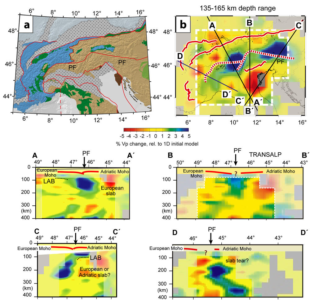
These studies will complement geophysical imaging, especially along the profiles and swaths (Figs. 1, 2). Geological investigations extend beyond the narrow confines of the swaths because surface structures suited for studying mountain-building processes do not everywhere coincide with the younger structures at depth or with the logistical constraints of station deployment.
Figure 2: (a) Tectonic map of Alps with locations of current and new passive seismic experiments: C and D - German swaths in this study, EASI - Czech-Austria-Swiss swath, CIFALPS - China-Italy-France swath; (b) Tectonic map with numbered stars showing potential targets of geological investigation at the surface (see text); (c) Moho depth map (Spada et al. 2013) and (d) tomographic depth slice as in Fig. 2b (after Lippitsch et al. 2003) with new seismic profiles and swaths in the AlpArray experiment.


