C - Dense station swath C (not installed)
The AlpArray network is augmented by several swaths of closely spaced stations (c. 12 km apart) that will be deployed for 2 years across key areas of the orogen and are embedded in the AlpArray network. The ~12 km spacing along the swaths will provide 10-15 km resolution of structures down to ~200 km depth. The German effort concentrates on swaths C and D (Figs. 1, 2).
Swath C (Activity C) – crosses the opposing Northern Apennine and Southern Alpine orogenic fronts and their forelands. It comprises a moving array of 7 x 9 stations that will be deployed four times to cover an area of 100 x 70 km. The swath includes the sites of the 2012 Emilia earthquake (Northern Apennines) and 1976 Friuli earthquake (Southern Alps). It will yield highly resolved seismic parameters (shear-wave velocity, attenuation) and allow us to quantify various site effects,most important, the amplification and extension of ground motion due to 2D and 3D effects, and secondary effects like liquefaction.
This activity has not been funded.
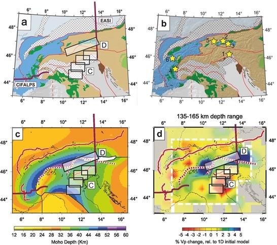
Figure 2: (a) Tectonic map of Alps with locations of current and new passive seismic experiments: C and D - German swaths in this study, EASI - Czech-Austria-Swiss swath, CIFALPS - China-Italy-France swath; (b) Tectonic map with numbered stars showing potential targets of geological investigation at the surface (see text); (c) Moho depth map (Spada et al. 2013) and (d) tomographic depth slice as in Fig. 2b (after Lippitsch et al. 2003) with new seismic profiles and swaths in the AlpArray experiment.
